Ok fellow Eastmans Forum members. I can’t wait anymore. I finally pulled the trigger, used all my points, applied for a high country early season rifle mule deer hunt and drew a unit 36 tag. I’m am extremely excited!!!
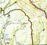
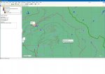
In an effort to use every bit of time between now and when I leave for the hunt, in early September, to prepare, I come to you you. I am wanting to do this hunt DIY so I began researching these hunts several years ago and heavily scouting this unit over the past few months. I have been looking at every map I can get my hands on (National Geographic Trail maps, Topo maps, Forest Service maps, BLM maps, etc), various sources of aerial photos (GE and Bing Maps mostly), and have spoken with the area Game Warden and Biologist several times. I feel I am starting to understand the area and have broken the area into 4 main parts.
Problem is I am no mule deer expert and all the nooks and crannies of the Gore Range appear to look great. I’m hoping to get out for a long weekend of scouting towards the end of July or beginning of August, but I may not be able to. Back-up plan is I will be arriving at least 5 days before season opener to get some boots on the ground and hopefully familiarize myself with the area before season opener and hopefully identify a few candidates.
If anyone has been to this area I would love to hear from you. Especially, if you have hunted this time of year on an archery, muzzleloader, or early rifle hunt. Even if you haven’t been to this unit, but have hunted similar “above treeline” hunts in other areas I would like to tap into your knowledge, too.
Do you have any pictures or knowledge you can share?
What do you look for on maps or aerial photos that help separate these high country spots out from one and another?
Do you find certain areas are more successful than others that can be identified when “map” scouting?
Obviously, I would think the farther away from people the better. But, one of my “four” areas that I identified has 5 trails that go through it each around 1.5 miles apart and running roughly parallel to each other. Do you think it is worth investigating the mid-points between each trails?
Anything I can look for on maps that I should avoid?
Anything I am missing?
") Ran another 8 miles yesterday.
Ran another 8 miles yesterday.