Gaia GPS vs. Onx

Mule3006Elk

Active Member
Jul 3, 2013
264
82
Any thoughts.
I use onX Hunt and I am happy with it.
Any advantage of Gaia GPS over onX when in the field?

Thanks
 

Eastfork

Member
Feb 14, 2016
82
0
I have use gaia, and onx. And now base map. For the price I feel base map is the best bang for buck. It does everything like onx but I feel better maps, and way easier to use. Better features and cheaper.try it out and let me know how you like it!!
 

brooks

Member
Aug 3, 2011
134
0
New Mexico
I have both of them right now and like them both but I will be getting rid of one of them when the subscription runs out. Both of them need maps downloaded before you go into a wilderness that has no cell coverage and a lot of times I end up in a place that I didn’t download the area so the most trusted device to me is my Garmin Oregon 650 T gps it has never been with out satellite signal.
 

Brianh

Member
Jan 1, 2013
98
0
Rhinelander, WI
I had issues with Onx this past year. I knew a parcel had changed ownership, and sent them an email telling them about it. They said they update every 12 months. Well after 14 months, it still wasn't updated. I'll be looking at a different service as I now don't trust them.
 

AndrewGaiaGPS

New Member
Feb 22, 2019
3
0
I am one of the founders and CEO of Gaia GPS, and I still work a lot on the code.

I'd be happy to answer any questions, and I'll also set you up with a free membership for a while if you email me at andrew@gaiagps.com.

One big project I'm helping with right now is custom onboarding for hunters. Currently, we see a lot of people try the app but get a little lost figuring out how to set up their map for hunting (i.e. they need to combine hunt units with private/public land and topos or satellite). So in a soon-to-be-released version we'll ask you if you're a hunter, geo-locate you, and configure your maps automatically. We have had lots of people tell us Gaia GPS is the best hunting app, but that it's a bear to get started, so we're aiming to fix that.
 

Mule3006Elk

Active Member
Jul 3, 2013
264
82
Thanks for the feedback.
I will say the satellite imagery is more crisp on Basemap and Gaia GPS compared to onX when using full zoom.
 

taskswap

Very Active Member
Jul 9, 2018
523
379
Colorado
I've used all three plus some other tools. My opinion (free advice being worth what you pay for it) is each has different strengths and weaknesses. I use a mix for my hike and hunt planning:

1. CalTopo has basically no hunt data or offline mobile app. But it's the best Web-based map for general hike planning, so I use it for scout planning. Caltopo can show the terrain profile for a route, which lets you cut out unneccessary 500' climb/descent bits you could have skirted around. It can do this both internally and also export a live KML link to Google Earth so you can do some real poking around for meadows, ponds, and other features you want to make sure you hit (efficiently).

Also, although it doesn't have a mobile app of its own, it can export KML files to whatever app you want. I'm an Android user and have found that Locus Pro is hands down the best GPS app for me, especially when I go offline. I can even make really nice printouts to leave with my wife "just in case".

2. I use OnX for hunt planning - not for routes (its marking tools are super primitive here) but for general data. And while CalTopo has public/private land use as a layer, OnX of course has a lot more detail on this. One annoying thing is the interface for downloading offline data is HORRIBLE. If you want to download all of the detailed views for a typically-sized Colorado GMU it takes like an hour of scrolling around trying to get 5mi rectangles overlapped efficiently and downloading it a rectangle at a time. I've also run into the same issue Brianh had above, where a piece of data was outdated.

3. I use Locus Pro as my primary GPS app on my phone. A cool feature of this is if you have an Android Watch you can even have the map on your watch! Yes, it's a geeky detail you might laugh at, but it's soo much easier to glance at your watch to see if you're more or less where you want to be than pulling out your phone or GPS (especially in any kind of weather). One really nice thing Locus excels at is tracking very detailed recordings while you're in the field. All these products can record your route, but Locus has a ton of tools as well - detailed stats in the app on your pace/time/terrain/etc, super easy "take a photo" additions (which get exported back to KML for viewing in CalTopo or Google Earth) which I use to note bedding areas, scrape, likely ambush spots, etc.

4. This past year I signed up for Basemap. It's "ok", not great. I feel like its base layers are better than OnX, while its tools are about the same (kinda disappointing). For example, motor vehicle use map data seems much clearer in Basemap than in OnX. That's really important to me because I hunt almost exclusively public land. Getting "access" is really important there and access doesn't just mean off a highway. Lots of times you want to get a few miles in on a forest service road, and those are all over the place in quality.

One big disappointment here was the hunt data. I just dropped $9.99 for it but didn't feel like I got much out of it. There's this right-side filter thing for tags, but it just gives you this big weird list of "Name 1, Name 2, ..." in a column and you have to click every one to see it. It's super clumsy and definitely not useful for me. I wouldn't even call it thorough. If you're a numbers guy you NEED to read all the detail in the Draw Recap report. What Basemap shows is just kind of weird and unhelpful.

5. Gaia is interesting. It feels much FASTER than any of the others, but it's also much more basic. There are only a few base map layers, and they can't be overlaid like the other apps, so if you're looking at topo you're not seeing satellite, and if you're looking at satellite, there are no labels on anything (like roads). On the other hand it looks to me like it has a lot of potential, it's basically where CalTopo was a few years ago (back when they also had only a few layers available) but with a more sophisticated interface. I'm keeping my eye on it and hoping it will grow.

6. AlpineQuest on mobile. There's no Web version that I know of. This one is interesting because it gets around a big issue with the other apps: offline satellite resolution. All of the apps by license/law have to limit the resolution you can download for offline use. But you're allowed to cache already-downloaded images for your personal use - you just can't distribute it. So the GPS makers have to limit what you can bulk download, even if you personally (under most licenses, like Google's) could download a few tiles yourself. You just don't have a way to do it...

Well AlpineQuest has a workaround. They don't let you bulk download. But you can scroll to a specific tile or two you want to see detail on (while you're still online) and it will cache that. There's a limit to this cache but you can get down to Google's "Level 20" (finest resolution) detail if you want. To be honest it's kind of a gimmick - at that level you need your eyes on the ground, not your GPS. But occasionally it's helpful for identifying a better route around a pond/bog or something like that.

Kind of breathy but maybe one or two of y'all will get some value out of this. If you want the TL;DR it's "CalTopo, Google Earth, and OnX at home, Locus Pro and OnX in the field, keeping an eye on Basemap and Gaia and hoping they improve."
 

AndrewGaiaGPS

New Member
Feb 22, 2019
3
0
5. Gaia is interesting. It feels much FASTER than any of the others, but it's also much more basic. There are only a few base map layers, and they can't be overlaid like the other apps, so if you're looking at topo you're not seeing satellite, and if you're looking at satellite, there are no labels on anything (like roads). On the other hand it looks to me like it has a lot of potential, it's basically where CalTopo was a few years ago (back when they also had only a few layers available) but with a more sophisticated interface. I'm keeping my eye on it and hoping it will grow.
I just wanted to say it sounds like you didn't poke around in Gaia GPS quite far enough, unless I'm misunderstanding.

1) You can overlays labels, topo lines, boundaries, etc on top of satellite. That might not have been clear, since you need to be in "Premium" mode for it to show the "layering" mode instead of the simple map menu.

2) For base maps, there are many options... USGS, USFS, non-government (OpenStreetMap) base layers, multiple sources of satellite imagery, international topo maps, etc.

This is really our fault that all these map layers are hard to find and compose together... we need to make how you configure your map sources more automatic and easy! This is something I was getting at earlier in the thread.

Send me a note at andrew@gaiagps.com, happy to give a few pointers too.
 

taskswap

Very Active Member
Jul 9, 2018
523
379
Colorado
I just wanted to say it sounds like you didn't poke around in Gaia GPS quite far enough, unless I'm misunderstanding.
You're right, those basemap layers are very buried.

Am I missing something on the features side, as well? I just made a sample route, a quick 7.5mi practice "plan". I couldn't figure out how to "close" it (how finish where I started - and what is the blue icon with the map pin supposed to do as you add points?) so I put the final point near the start and hit Save. I get this:

Screen Shot 2019-02-28 at 5.04.32 PM.jpg

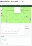
Not sure why it doesn't show the route here on this sample map, looks like a bug. In the screenshot I captured the export options. If I want to see the route on the main map, I can click that, but once there, there's no way to manage routes in that interface. Like, if you want to edit or delete a route you need to click into the detail for it again. Maybe another "secret feature"?

Experience in CalTopo, same route (I imported the KML):

Screen Shot 2019-02-28 at 5.10.30 PM.jpg

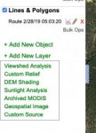
Notes: I can directly edit routes right on the map, show or hide them, and see a list of all of them (and click to jump to them, if one is off the map). I have a ton of options for editing routes, as well - being able to "split" and join them is really helpful when I start planning overnights because I can figure out likely camp sites as secondary steps and break the route into chunks from there. I can also do layer presets for different config sets of layers on/off, and I have more export options.

The Gaia KML export is weirdly inefficient by the way, it looks like it interpolates points unnecessarily. When I import the route into another viewer I get this:

Screen Shot 2019-02-28 at 5.16.11 PM.jpg

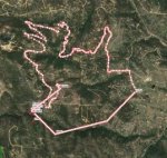
The top part is expected/desired - Gaia is (correctly) "snapping" to a known trail so it's just using the points from that polyline. But the bottom section should not look like that - I only added two direct-line points myself. This is a problem when importing into a GPS where you have it show a vector to the next waypoint - it doesn't show the proper distance to the next turn point. It looks to me like it inserts an artificial route point every 100yds or so, even on straight lines. I don't see an option to turn this off.

Not shown in the Caltopo export drop down (it's a paid feature and my account is past due, my credit card expired and I forgot to update it because I don't map much in February!) is a "Network KML" option that's SUPER useful. If you open one of these in Google Earth (which I find more convenient for looking for draws, gullies, and other terrain features I want to "work around") they live-update. So if I look in Earth and see my route is going right up the center of a gully and I'd rather work a ridge on the side of it, I can update the route in CalTopo, then it's automatically updated in Google Earth without re-downloading the KML over and over.

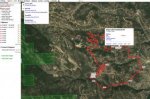
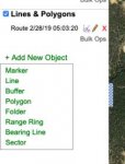
Finally, the objects you can add are a killer feature for me. I use ViewShed Analysis CONSTANTLY for finding spots to glass from:

Screen Shot 2019-02-28 at 5.21.18 PM.jpg

Screen Shot 2019-02-28 at 5.21.25 PM.jpg

I can't add more attachments here to show a sample but you get the idea.

Note that these aren't necessarily criticisms of Gaia. You brought up points about its features and I'm just responding with feedback. CalTopo is THE MOST sophisticated mapping app I've ever used, and competing with it may not be your goal. That's fine. I'm uber-map-geek and may not be your target demographic. That's fine, too. Just sharing my thoughts.

In my opinion, no app fits 100% of the need for hunters. On the Web, nothing can compete with CalTopo for raw mapping functionality, but the developer has shown no interest in adding features for hunters (public-land is a layer, but no hunt data like Onx/Gaia/Basemap) and there's no offline/mobile app at all.

On mobile, Locus Pro (at least for Android) is the best raw mapping app I've ever used - it's almost "CalTopo for mobile" as far as features are concerned. But again, it has no features for hunting (currently I use OnX to make sure I'm not trespassing).

For hunt planning, frankly, everything falls short for me. OnX and Basemap seem to have the most configurable layers for species data, but OnX has no statistical data available (e.g. info on tags, draw stats, etc.) and while Basemap does, it's presented so dreadfully that it's basically unusable. Gaia has very limited data here - now that I found the "map manager" I can see some CO layers, but they're really basic (and require a premium sub): GMUs for different species plus WIAs and STLs. No species data/concentration areas/etc or draw/hunt stats.

In case you're curious, I have 5 stages to my "planning" each year:

1. (Around now) Planning for the draw, reviewing recaps and harvest data and cross-referencing to the maps to identify new zones I may want to hunt. No product fills this need - it's a manual slog through each GMU to find something I might like (and be lucky enough to draw). If I pay for anything new, it will be something that helps me here.
2. Scout planning. Once I draw, (or often before, on a hunch) I'll plan scouting hikes around where I might be hunting, taking note of bedding areas, migration routes / funnels, etc. I use CalTopo for this exclusively.
3. Scouting. Not just following a route, but often going a fair ways off it following sign / trails yet wanting to return to it. Taking lots of photos and notes about what I find. I use Locus Pro for this.
4. Hunt Planning. Going back through everything above and making a final plan for the hunt. CalTopo again, importing data from Locus.
5. Hunting. Pretty much just OnX. I don't spend much time messing with my GPS here - I'm following my nose and eyes. If I check it once or twice an hour, that's a lot.

Anyway, my 2c. Private message me if you want to talk more.