fire_man_luke
New Member
- Sep 22, 2012
- 2
- 0
I talked to a Forest Service LEO about that map, she said there was some legal weight to the maps as it was brought up as an authoritative document in a legal case when pinning a wildfire ignition on some target shooters. Apparently Manzanita Flats Shooting Range is in the no rifle zone? (Haven't verified if its true yet) However, she was adamant that anyone can shoot a rifle anywhere in the National Forest as long as it was safe, responsible, and 150 yards away from dwellings, roads, etc. In addition, the mountain communities are not incorporated cities, so they fall under County responsibility and law. I've asked several SB County Sheriff Officers,(they'd be the ones enforcing a County code) none of which could tell me if it was legal/illegal to shoot a rifle in a certain area. That map says it's ok to shoot a rifle in a residential area next to Lake Arrowhead Elementary school but you can't near Manzanita Flats or Heaps Peak? I think these kind of inconsistencies is why most hunters out there just disregard that map to begin with, nobody will enforce it and sometimes it just doesn't make any sense.
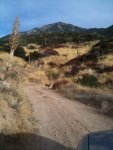
I try to scout more each year as I find more spots holding deer. Lately, that's what archery season turns into, a 23 day long scouting session! Thanks for the advice!
I try to scout more each year as I find more spots holding deer. Lately, that's what archery season turns into, a 23 day long scouting session! Thanks for the advice!